Citing “short-sighted fire suppression policies and the rapid influx of people and development in hazardous regions,” Meghan Hodges argues for incentivizing wildfire-safe developments through fire-hazard mapping coupled with fire-adapted building codes and robust code enforcement.
Hodges’ assessment was recently published in the Duke Law Journal and calls for spending federal monies to “prophylactically prioritize risk reduction” based on hazard mapping instead of the current (and more costly) approach of responding to fire disasters after they happen.
To ensure that federal funding reduces the damage from wildfire disasters, Hodges calls on Congress to help local and state governments by identifying “at-risk regions through hazard mapping and conditioning future aid on proactive resilience efforts.”
While wildfire-risk mapping “can enhance a community’s awareness of its risk of wildfire,” Hodges advocates for “an enforcement mechanism so that individual developers or communities cannot side-step heightened building codes.”
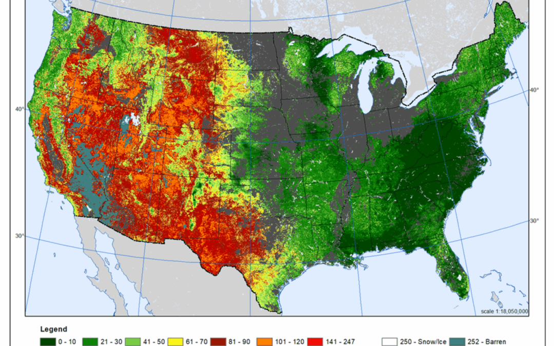
Photo: This Wildland Fire Potential Index map provides a general idea of what a wildfire-risk map would look like (U.S. Geological Survey image).